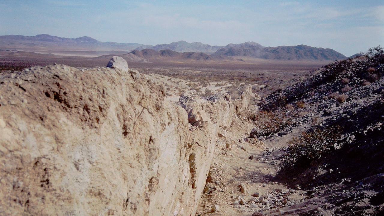


Magali Billen remembers her first encounter with the tectonic forces she’d eventually study. It was the morning of June 28, 1992. At 4:57 a.m., a 7.3-magnitutde earthquake that shook most of Southern California awoke her.
“I actually remember waking up in bed and seeing the doorway sway back and forth,” recalled Billen, who was in high school at the time. “After that, I would wake up in the middle of the night thinking that I felt shaking and hide under the desk.”
The Landers earthquake was the largest to strike the contiguous United States in 40 years. For Billen, the experience wasn’t just a manifestation of the physical forces constantly moving beneath our feet. It was a spark that ignited an academic interest in earthquakes and, more broadly, geophysics.
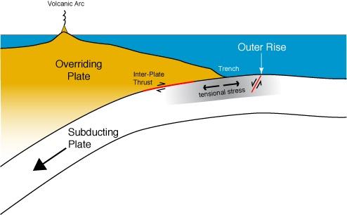
As a professor in the Department of Earth and Planetary Sciences, Billen seeks to unravel the forces that drive plate tectonics from hundreds of kilometers beneath the Earth’s surface. Specifically, she’s interested in subduction zones — areas where two tectonic plates collide, causing one to dive back down into the Earth’s mantle.
“The thing that’s fascinating about this question is that we can observe from the surface, we have indirect observations of the inside of the Earth, we have experiments on rocks at high pressures and temperatures, but we can never go in directly and measure what’s happening in the subsurface,” Billen said.
Unraveling the secrets of subduction zones
A specialist in numerical and computational modeling, Billen is a synthesizer of data. She combs through the scientific literature, collecting data from fields like volcanology, geology, geochemistry, geophysics, seismology, geomorphology and many others to create simulations that, when compared with other parts of her collected data, may one day help predict seismic events.
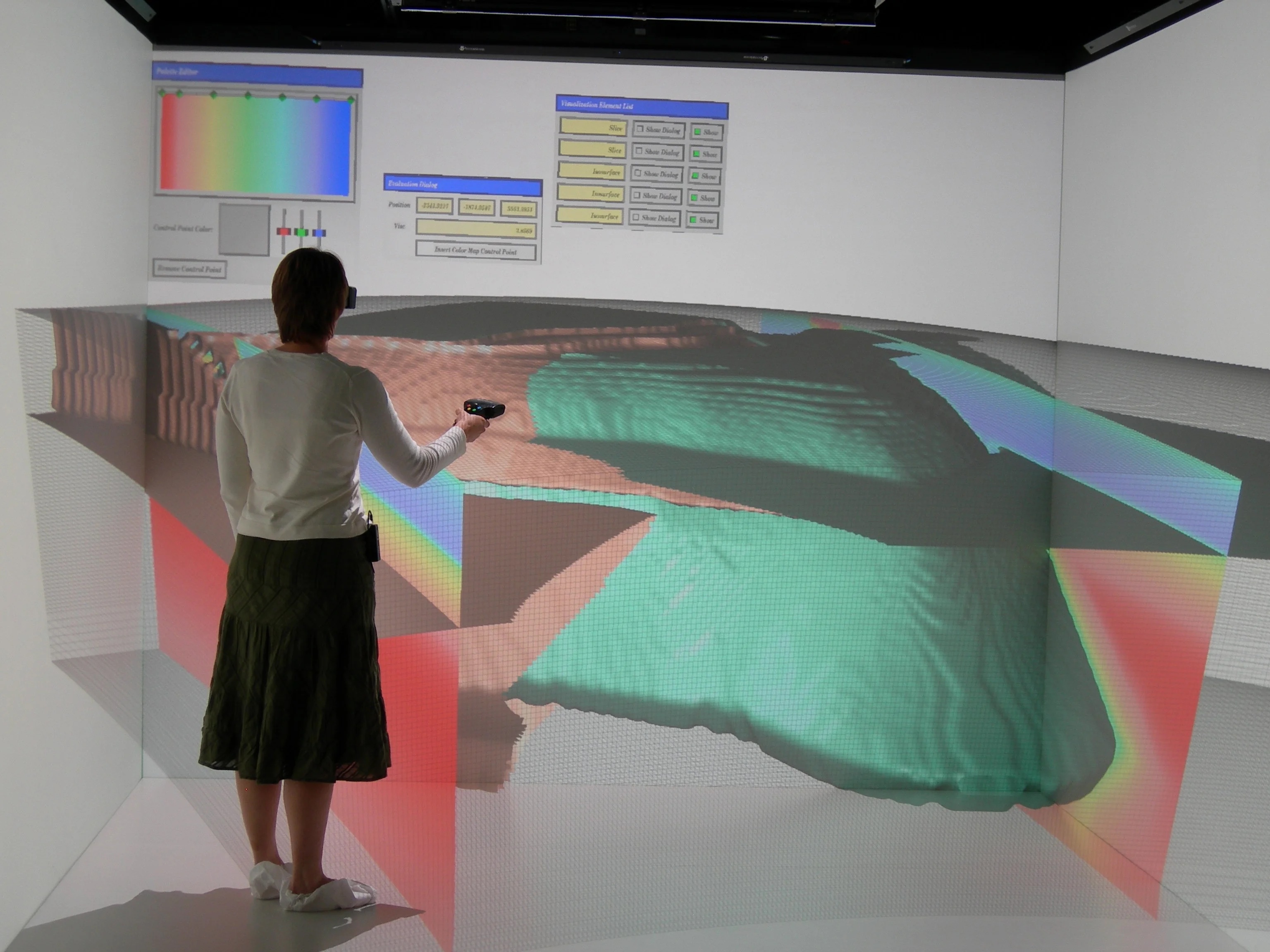
“I’m basically building what you might think of as a digital twin of the Earth,” Billen said. “And I’m trying to make it as real as possible by taking everything we know from all these different perspectives of observations, experiments and numerical methods.”
Billen’s digital twin of the Earth is informed by aggregate observational, experimental and numerical data from various tendrils of seismic research. But the digital twin starts as an empty box.
“We take a chunk of the Earth that goes down 1,500 kilometers and that’s thousands of kilometers across and now, we need to fill it up,” said Billen, noting that the big chunk is then separated into smaller cubes. “So, what are the materials that sit in all of those volumes? What’s the rock in each cube? What’s the temperature? How does that rock deform?”
That information is fed into the model until it’s reminiscent of the physical Earth. The model is then run to solve physics equations for the balance of forces to predict how tectonic plates will move and to see where stress builds up over time.
From solar evolution to the Earth beneath our feet
After the Landers earthquake in 1992, Billen thought about becoming a civil engineer. She wanted to design bridges and infrastructure capable of withstanding the physical onslaught of earthquakes. Always academically minded, she graduated from high school at 15 years old and went on to study physics at the University of Puget Sound, becoming the first person in her family to pursue higher education.
Despite having no familial examples to follow, Billen found a path. By the end of her sophomore year, she knew she didn’t want to pursue civil engineering. The classes on concrete and steel paled in comparison to the physics classes focused on classical mechanics and thermodynamics.
Eventually, her interest returned to earthquakes when she attended a National Science Foundation-funded workshop at Oregon State University focused on growing women’s participation in STEM fields. There, she learned about the growing hyphenated science fields.
“That was the first time I found out that there was actually something called geophysics, and that instead of building bridges related to earthquakes, I might actually study earthquakes,” she said.
Inspired, Billen enrolled in the geophysics program at the California Institute of Technology, where she eventually joined a research project focused on materials deformation and subduction. The work would require numerical modeling skills, something Billen had yet to develop.
“I hadn’t studied any of this stuff before,” Billen recalled. “And the project lead Michael Gurnis was like ‘What do you think you’re here for?’”
For Billen, who suffered from imposter syndrome at the time, that experience was a reminder that she didn’t need to be an expert from the jump. The point of a graduate degree was to expand her knowledge. Today, Billen tries to relay this lesson to her students.
“I think a lot of students don’t realize that,” she said. “You’re not supposed to know the answer. You’re supposed to build on what you’ve learned before.”
Back on digital Earth
Currently, Billen and UC Davis postdoctoral scholar Menno Fraters are building a digital twin for the Cascadia Subduction Zone, a 700-mile fault that runs from Northern California to British Columbia.
“Subduction zones are really driving the large-scale motion of tectonic plates around the surface of the Earth,” Billen said. “And when you have large forces that are pushing plates together, you’re going to get big earthquakes.”
Subduction zone earthquakes have a huge societal impact. The 2004 Indian Ocean earthquake and tsunami that killed over 200,000 people was due to a subduction zone. They’re potential disasters waiting to happen.
The Cascadia Subduction Zone hasn’t produced an earthquake since the year 1700, and scientists predict there’s a 37% chance the Pacific Northwest will experience a megathrust earthquake of 7.1+ magnitude within the next 50 years.
“The new model of the Cascadia Subduction Zone and growing focus on geohazards in the subduction community has really opened up my thinking on what we should be aiming for in terms of one day forecasting earthquakes like we forecast tornadoes or lighting storms,” Billen said. “Working with the Subduction Zones in Four Dimensions community initiative, I can imagine one day having subduction models in which we can monitor how stresses are built up, transferred and released, on a weekly or daily basis. We are a long way from that goal — but for the first time, I can see how we might get there.”
Creating an accurate digital replica is a tall order, one that Billen juggles with a myriad of other commitments. She’s a mother of three and is about to step into the role of Chair of the Department of Earth and Planetary Sciences. Billen credits her longevity at UC Davis— she joined the faculty in 2003 — to the campus community.
“I love the people and I love the environment,” she said. “It can be a challenge, but it’s such a privilege to be part of a university that’s supportive of faculty with families.”